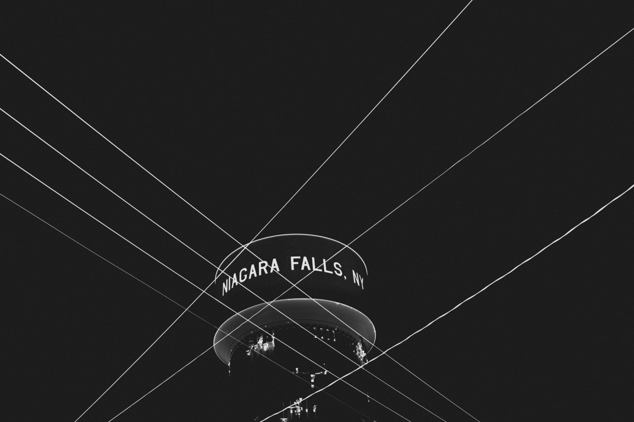
Driving through America’s Honeymoon Capital, Niagara Falls, one might hear the roar of the waterfalls, but this roar can’t silence the echoes of a buried secret: this city is heavily radioactive. Niagara Falls’s involvement in the Manhattan Project and the nuclear buildup that followed during the Cold War left a radioactive scar on the region. For thousands of years, this area will face the consequences of this contamination.
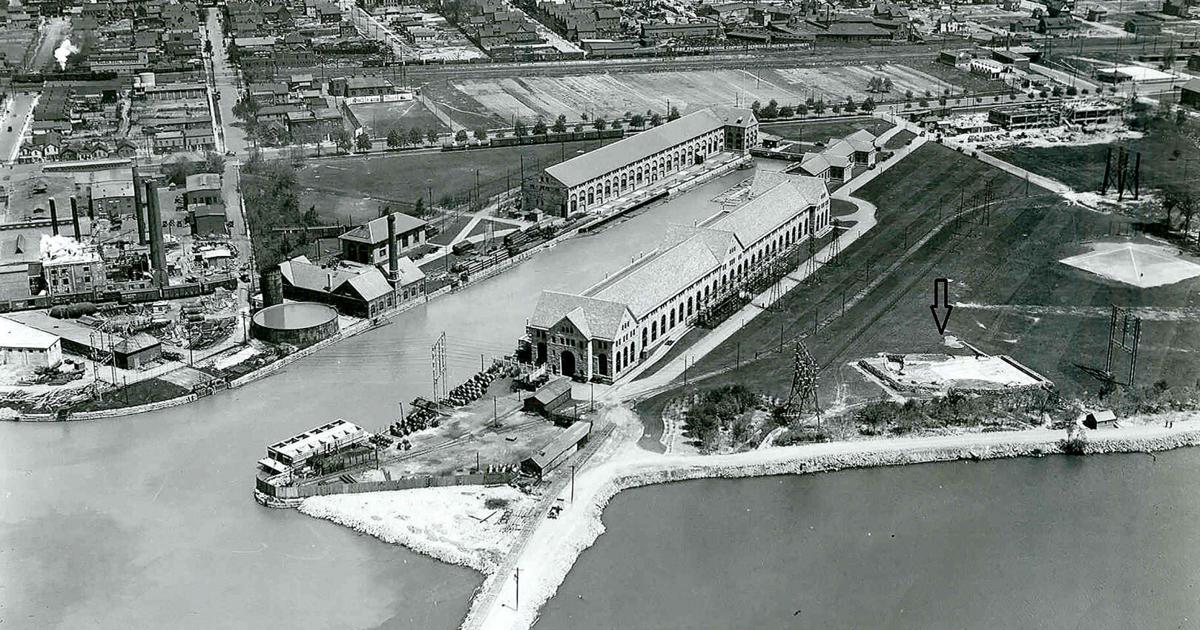
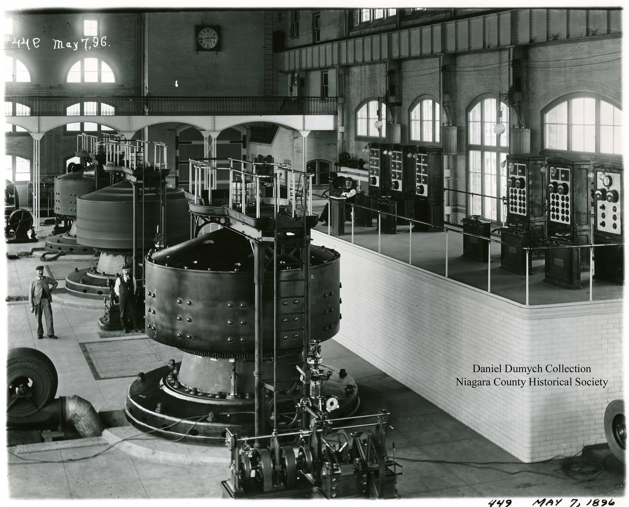
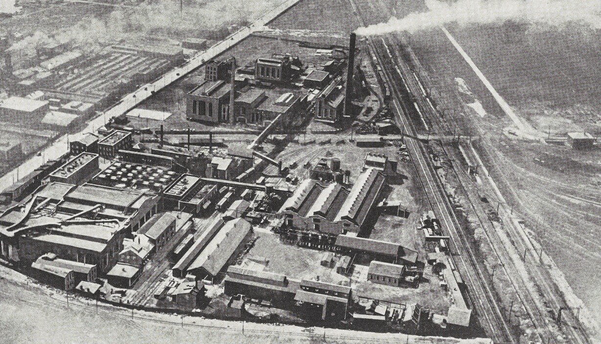
The origin of this American tragedy is rooted in what attracts tourists year after year: its waterfalls. Niagara Falls has long been a source of cheap and abundant hydroelectric power. In 1895, the Adams Power Station became the world’s first large-scale alternating-current power plant, supplying the city’s factories with cheap, abundant, reliable electricity.
Adams Power Station and the surrounding industrial landscape
Origins1896
Inside Adams Power Station
Adams Power Station · May 7, 1896 · Daniel Dumych Collection, Niagara County Historical Society
Origins1895–1942
Electrochemistry +electrometallurgy
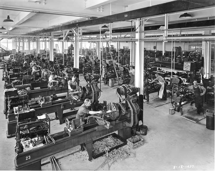
This new supply of electricity opened a new era of metal production and electrochemical discovery. Electric furnaces could reach temperatures exceeding 7,000 degrees Fahrenheit, enabling chemical changes in materials that had previously been impossible.
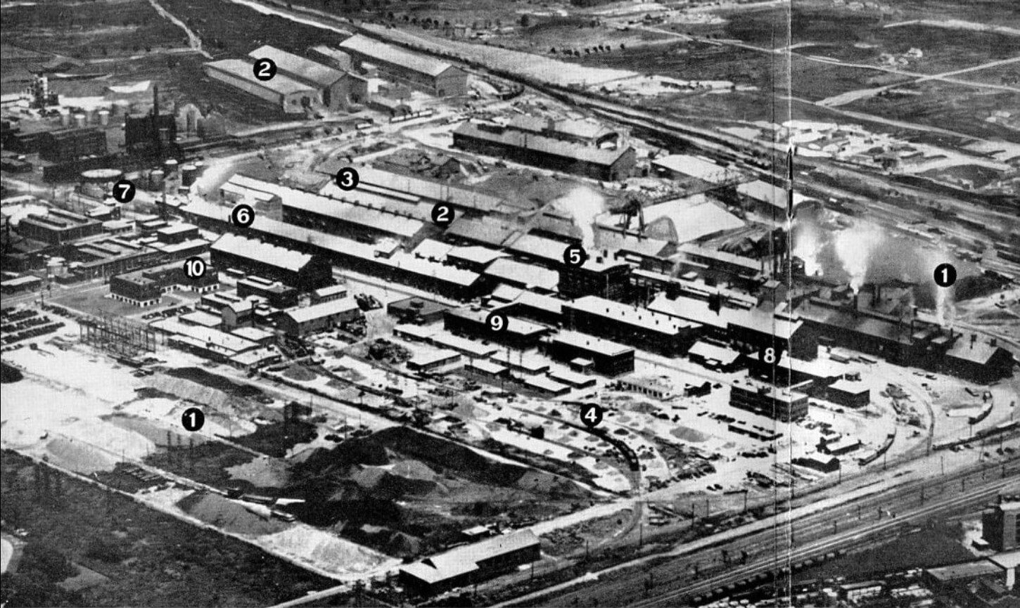
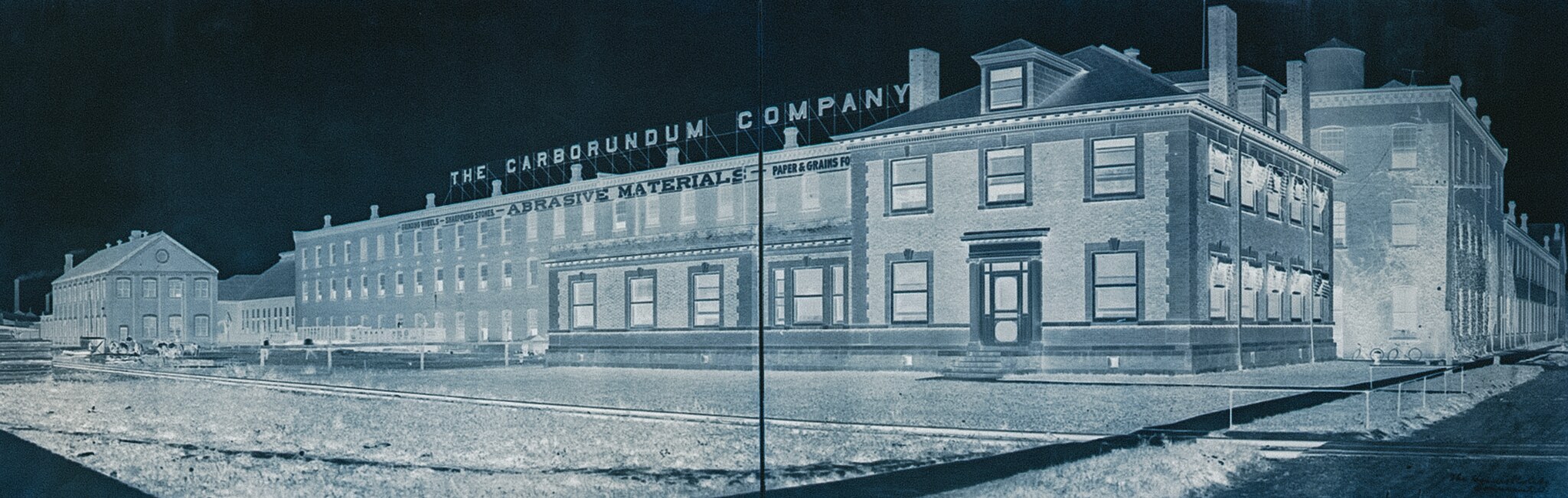
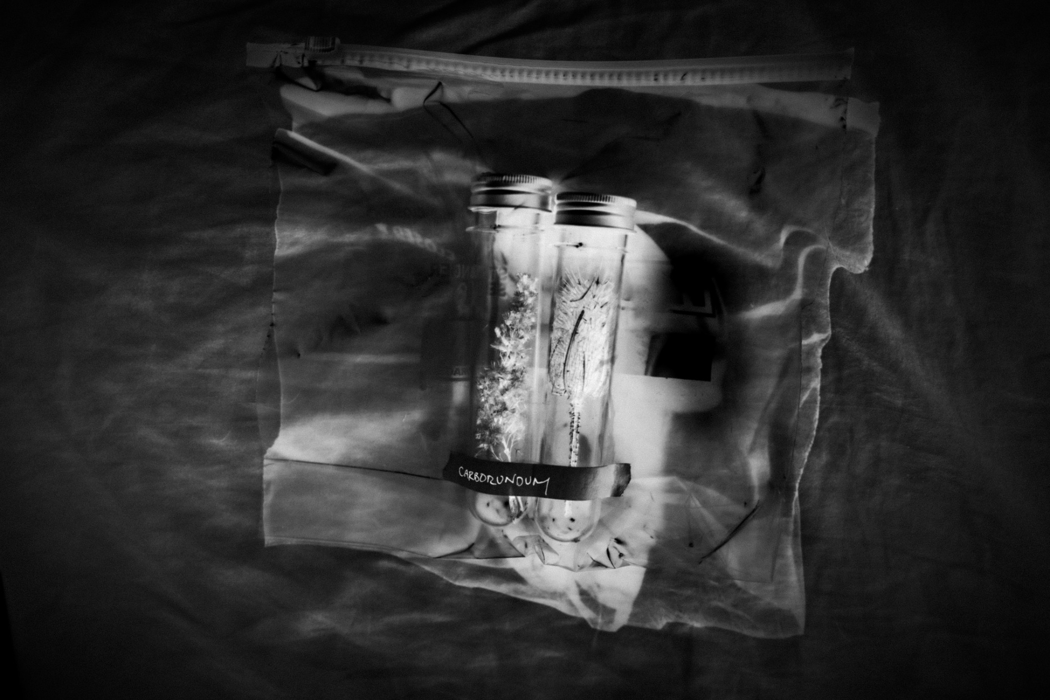
Hooker produced chlorine and caustic soda. Linde produced industrial gases. Electromet manufactured specialized alloys and became the nation’s largest producer of uranium metal. Vanadium strengthened steel. Carborundum pioneered the synthetic abrasive that transformed industrial grinding and cutting. These were not ordinary factories.
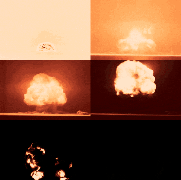
Trinity test · July 16, 1945 · U.S. Department of Energy / Wikimedia Commons · Public domain
Leslie R. Groves · Director of the Manhattan Project
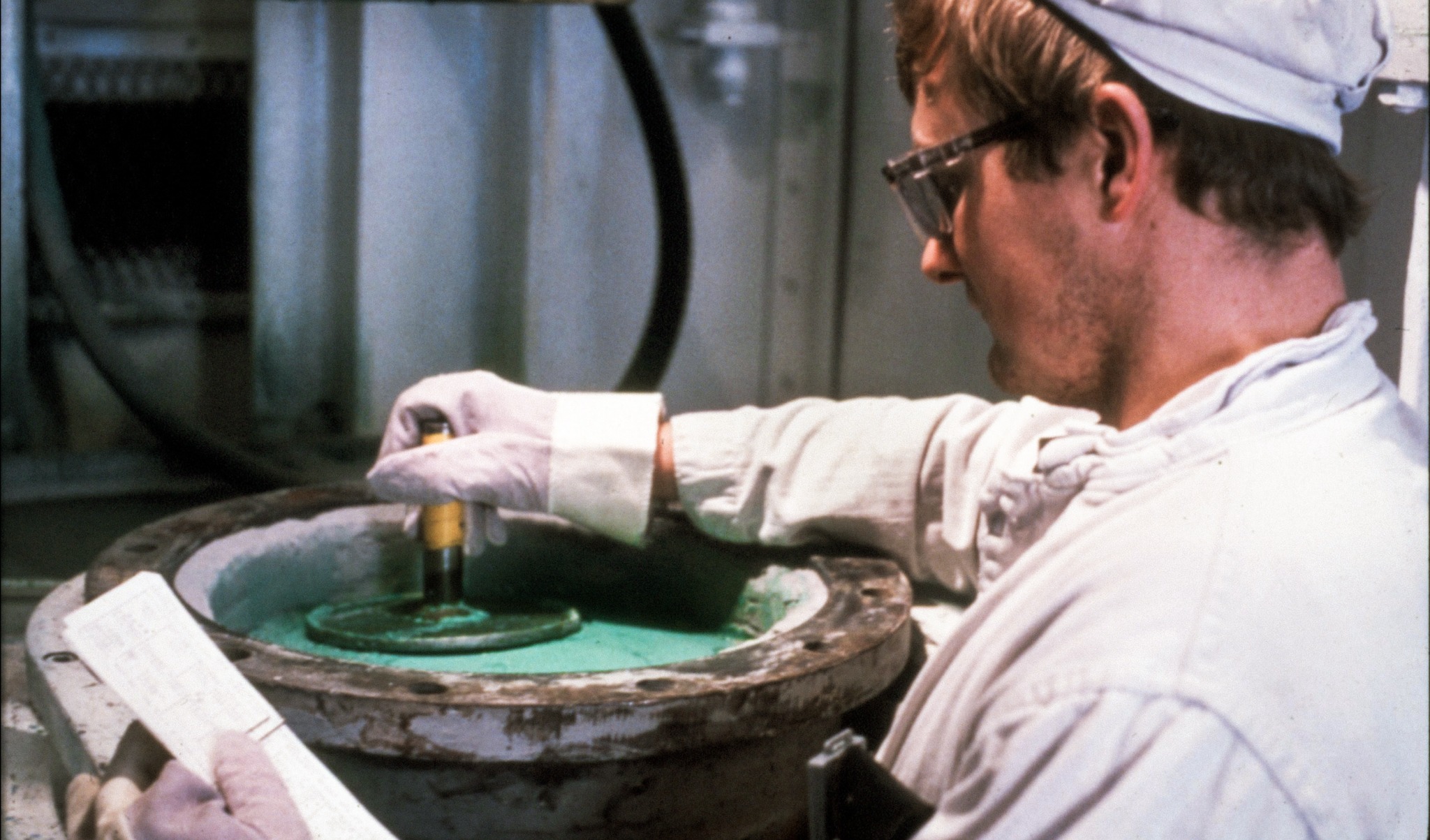
Uranium tetrafluoride · “green salt” · U.S. Department of Energy
03
Uranium recovery
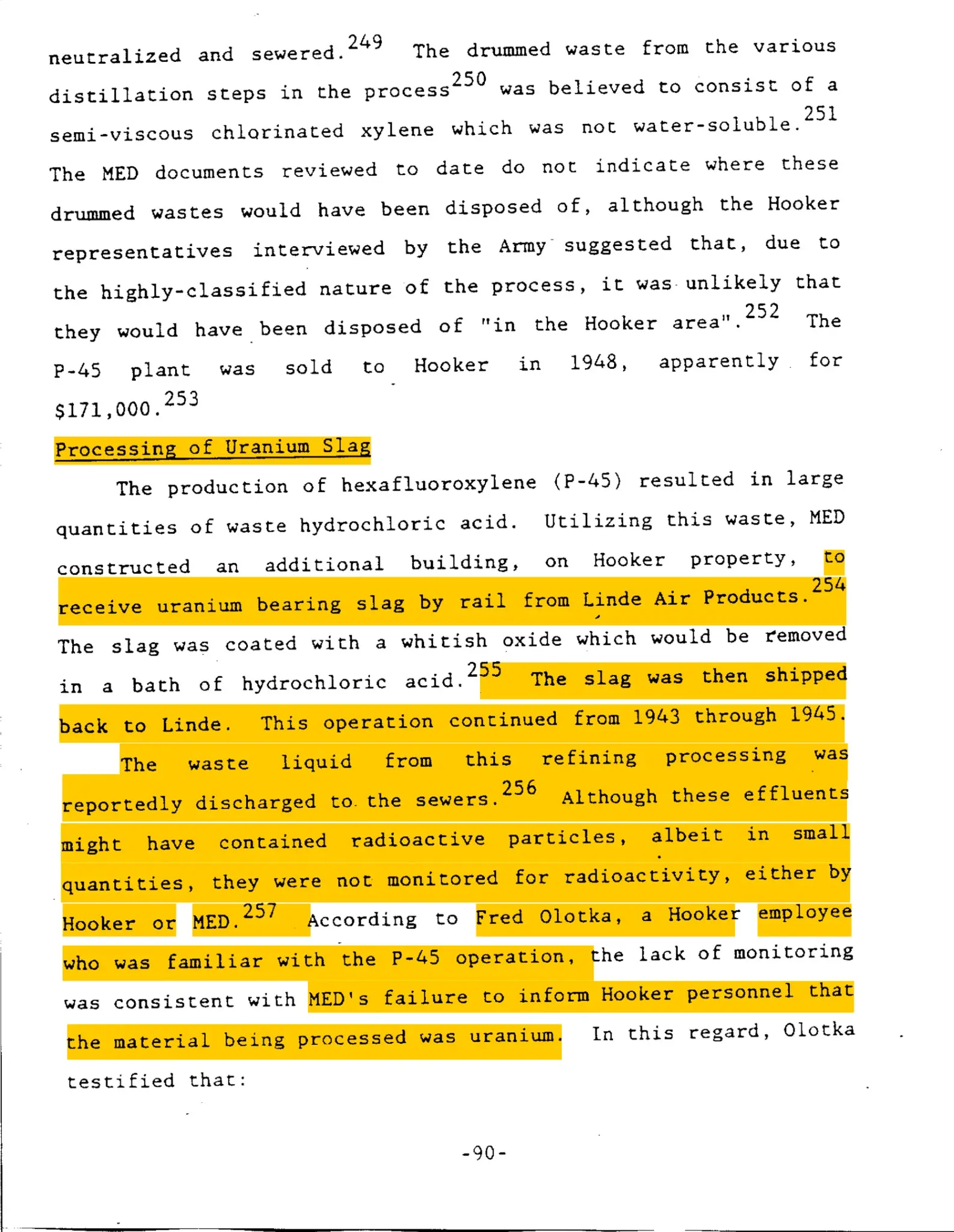
At Hooker, uranium-bearing slag was treated with acid; the unmonitored liquid waste went to the sewers.
Processing of uranium slag · Hooker · 1943–1945
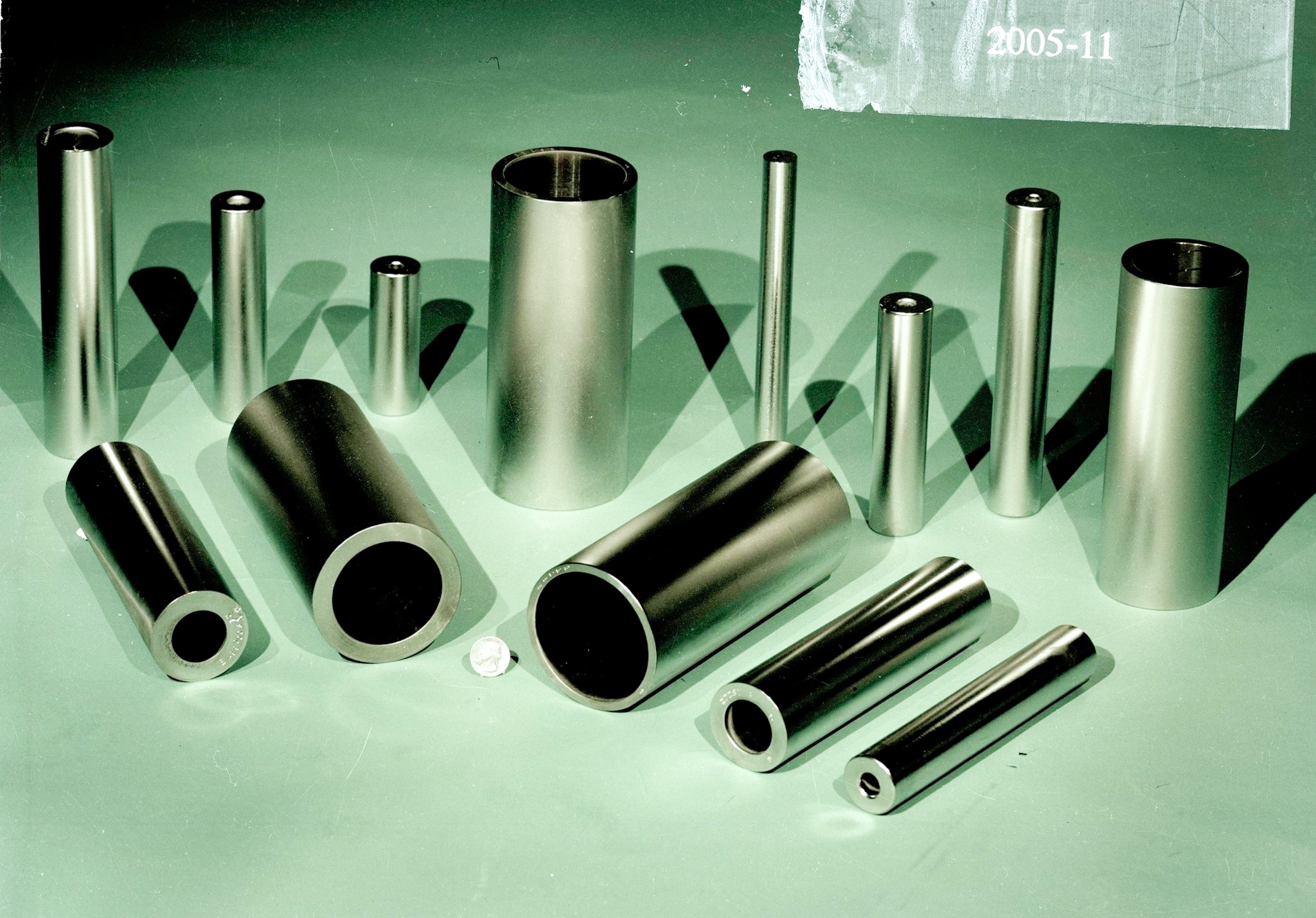
Uranium metal rods · final product
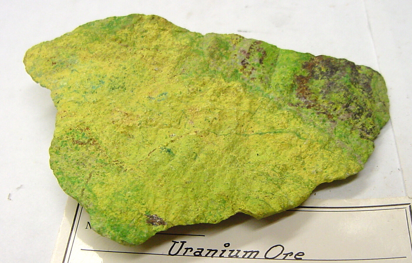
Uranium ore · Shinkolobwe, Belgian Congo · collected 1965
From green salt to uranium metal
Driven by the urgency of World War II and the atomic bomb project, this region became the nation’s leading center for processing and refining much of the uranium needed for the bomb. The principal contractors operated their own laboratories, where scientists worked across the production process to extract as much uranium as possible—not only by recovering it from residues, but also by improving refining, conversion, reduction, and fabrication. The federal government maintained offices within the major plants, placing its representatives directly inside the industrial network. General Leslie Groves cultivated close ties with regional factory owners, valuing their commitment to confidentiality and the protection of sensitive information. That secrecy exposed thousands of workers to radioactive materials. Niagara’s atomic role did not end with the war: it continued throughout the Cold War, including Bell Aircraft’s development of RASCAL, the U.S. Air Force’s first air-launched nuclear missile.
The process
01
Linde Ceramics Plant
Tonawanda, New York · Union Carbide
Before the Manhattan Project, Linde’s ceramics business used uranium compounds to produce colored salts for ceramic glazes—the origin of the name Linde Ceramics. That chemical experience helped lead the Army to select Linde for large-scale uranium processing.
Linde Air Products, a division of Union Carbide and Carbon Corporation, converted high-grade uranium ore—much of it mined in the Belgian Congo—into uranium tetrafluoride, or “green salt,” for shipment to Electromet in Niagara Falls. The work generated a vast waste stream.
In 1944, after a process change made the liquid waste too caustic for the sanitary sewer, Linde proposed two alternatives to the Army: discharge it through a storm sewer into Two Mile Creek and ultimately the Niagara River, or inject it into an onsite well. Linde’s legal department favored the well because the path of underground water would be difficult to determine and “responsibility for contamination could not be fixed.” The Army replied that it had “no objection” to either plan. Linde chose the well; when the injection wells became blocked, the waste was discharged into the storm sewer. Federal estimates indicate that approximately 55 million gallons entered seven injection wells and another 56 million gallons entered the storm-sewer system.
Solid radioactive residues were sent to Ashland 1 and later spread to Seaway and Ashland 2. Linde and the three disposal properties became federal cleanup sites under the Formerly Utilized Sites Remedial Action Program, or FUSRAP—the program responsible for cleaning properties contaminated by Manhattan Project and early federal atomic work.
Electro Metallurgical Company, known as Electromet, was another Union Carbide company. Before uranium, its electric furnaces produced calcium carbide, ferroalloys, tungsten, titanium, and other specialty metals. This high-temperature metallurgical expertise made Electromet suited to convert green salt into uranium metal.
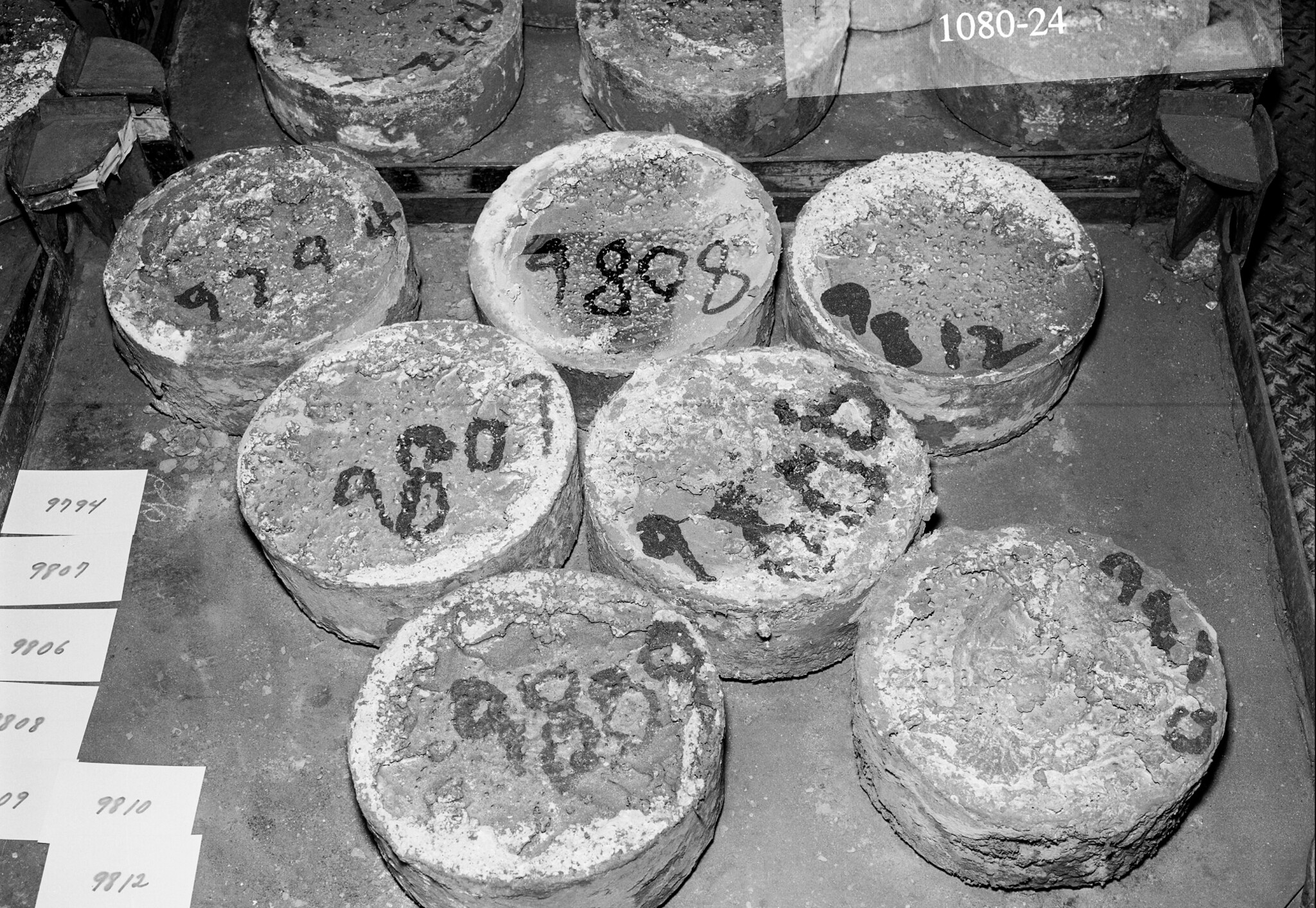
Workers mixed uranium tetrafluoride with magnesium inside a dolomite-lined steel vessel known as a “bomb.” When heated, the mixture underwent a violent thermite reaction. The uranium separated, pooled at the bottom, and was cast into 110–135-kilogram ingots, then recast into billets. The process left uranium-bearing C-1 and C-2 slag. A later private investigation described haulers taking waste from Union Carbide’s Niagara Falls operations to the company landfill—then known as Newco and now part of the CECOS hazardous-waste facility—while also selling or giving away untreated slag from the plant as inexpensive construction fill.
Before its uranium work, Hooker used Niagara’s cheap hydroelectric power to electrolyze salt into chlorine, caustic soda, and hydrogen. Its products included bleach, water-treatment chemicals, solvents, and other industrial compounds.
Under its Manhattan Engineer District contract, Hooker also manufactured fluorinated and chlorinated organic chemicals. One product, xylene hexafluoride, was known by the wartime code P-45. Although P-45 itself was not radioactive, its production generated waste hydrochloric acid.
Hooker used this acid in a separate uranium-recovery operation, treating C-2 slag delivered from Electromet’s uranium-metal reduction vessels. The slag consisted largely of magnesium-fluoride residue and spent dolomite liners—materials that still retained recoverable uranium. Workers opened and screened the barrels, separated uranium-rich pieces, conveyed the remaining material to digest tanks, treated it with acid, neutralized it with lime, filtered and washed the slurry, and rebarreled the concentrate. The process increased the uranium concentration from roughly 0.2 percent in the incoming material to approximately 1–2 percent in the resulting concentrate.
The recovered uranium concentrate was shipped by rail back to Linde in Tonawanda, where it reentered the production cycle—refined again into green salt and returned to Electromet for conversion into uranium metal. The process then began again.
Bethlehem Steel in Lackawanna and Simonds Saw and Steel in Lockport—the plant later known as Guterl Specialty Steel—formed the rolling and finishing stage of the regional uranium chain. Simonds became the program’s principal rod manufacturer, rolling uranium metal billets into long rods from 1948 through 1956. Bethlehem finish-rolled some bars rough-rolled at Simonds, heat-treated and ground uranium rods, and helped develop continuous-rolling methods later used at Fernald.
Today, the former Lockport plant—later known as Guterl Specialty Steel—is an active FUSRAP cleanup site, part of the federal program addressing contamination left by early atomic-weapons and energy production. New York State also identified the Guterl plant and landfill as potential sources of contamination to Eighteenmile Creek.
The finished rods were shipped to Hanford in Washington State, where they were cut and machined into short fuel slugs, canned, loaded into production reactors, and irradiated to produce plutonium for nuclear weapons.
In 1943, DuPont sent Carborundum ten unfinished uranium slugs—about thirty pounds of metal—to determine which abrasive wheels and grinding speeds should be used to finish reactor fuel. These centerless-grinding experiments supported the production of uranium slugs for the Clinton and Hanford reactors. The surviving records do not establish whether this work occurred at the Buffalo Avenue site or the Globar Plant.
Carborundum’s nuclear work expanded dramatically from 1959 through 1967 at its Central Research Laboratory on Buffalo Avenue. There, researchers developed uranium nitride, uranium carbide, and uranium silicide as possible alternatives to uranium dioxide and devised methods for synthesizing, forming, and testing these materials as reactor fuels.
Beginning in 1960, plutonium shipped from Hanford arrived at Carborundum for the AEC’s Carbide Fuel Development Program. Inside a classified fourth-floor laboratory, workers mixed uranium and plutonium compounds, heated them in furnaces, pressed and sintered the material, and ground it into experimental uranium–plutonium carbide fuel pellets. The program investigated fuels capable of longer burnups and higher power in advanced reactors.
At the same time, Bell Aerospace was developing the RASCAL, the United States Air Force’s first nuclear-armed standoff missile—an air-to-surface, supersonic guided missile designed to deliver a nuclear warhead.
Bell and the Atomic Energy Commission operated a test center north of Balmer Road on the former Lake Ontario Ordnance Works (LOOW), a 7,567-acre federal site in Lewiston and Porter originally built during World War II to manufacture TNT. The facility became known as the Bell Test Center.
In 1967, the site was temporarily used to house the Lewiston-Porter School while a new school building was under construction and scheduled for completion in 1970. During that time, 275 students, along with their teachers and administrative staff, attended classes at the site. This matters because children and staff were placed on a former military-industrial site where radioactive materials had already been stored and buried, without the site’s full history being publicly legible.
The Lake Ontario Ordnance Works was a vast U.S. Army industrial site constructed during World War II to manufacture TNT. After explosives production ended, the Manhattan Engineer District repurposed part of the site as its official regional repository for radioactive waste from Western New York’s uranium program. Beginning in 1944, residues and contaminated materials were brought there for storage, repackaging, burial, and disposal. Not all of the region’s waste reached LOOW; much of what did was concealed by secrecy, buried, and ultimately forgotten.
1978–1981 A chemical disaster opens a second archive.
The records begin to surface
Love Canal + The Federal Connection
Residents forced the government to confront one buried history. The investigation exposed another: a regional uranium-production and waste network.
Investigators entered Love Canal looking for one history of chemical disposal. The inquiry opened a second archive: a regional system of wartime uranium production and the movement, reuse, and disposal of its radioactive waste.
For decades, the waste left by this industrial system remained hidden. It began to surface only after the crisis at Love Canal. Love Canal was a working-class Niagara Falls neighborhood built around an unfinished canal that Hooker Chemical had used as a hazardous-waste landfill. From 1942 to 1952, the company buried more than 21,000 tons of chemical waste there.
In 1953, as Niagara Falls struggled to accommodate its growing postwar population, Hooker sold the covered landfill to the Niagara Falls Board of Education for one dollar. The deed disclosed the presence of industrial waste and included a liability disclaimer. Despite that warning, the 99th Street School was built on the middle third of the landfill, and the surrounding area was developed with homes and low-income apartments, many directly along the canal’s edges.
By the late 1970s, chemicals were surfacing in yards, basements, sewers, and school grounds. Residents reported cancers and other illnesses, while state investigators documented a significant excess of miscarriages among women living on 99th Street South and congenital malformations among children born in the neighborhood. One grandmother told an EPA official that two of her four grandchildren had been born with defects: a granddaughter was deaf and had a cleft palate, an extra row of teeth, and a cognitive disability; a grandson had an eye defect.
Lois Gibbs, who founded the Love Canal Homeowners Association, and Luella Kenny, a Love Canal resident and research scientist at Roswell Park whose seven-year-old son died of kidney disease, helped turn those private experiences into a national environmental crisis. Residents organized, protested, and forced state and federal officials to respond. Emergency declarations in 1978 and 1980 ultimately led to the evacuation of approximately 950 families. Love Canal became a major catalyst for the 1980 Comprehensive Environmental Response, Compensation, and Liability Act—the law that created Superfund—and its resident-led activism became a model for the modern environmental movement.
Love Canal itself was a chemical-waste disaster. But the Assembly inquiry began with eyewitness allegations that United States Army personnel had dumped toxic waste into the canal—and with questions about whether the Army’s own 1978 investigation had adequately examined those claims. To identify the soldiers witnesses remembered and determine what they might have been transporting, the Task Force had to reconstruct the history of federal defense activity across Niagara and Erie Counties.
That search expanded far beyond Love Canal and revealed that the region’s contamination was also radioactive. The Task Force traced the uranium-production chain through Linde, Electromet, Hooker, and other federal contractors; documented Linde’s underground disposal wells; and investigated the storage, burial, loss, and reuse of radioactive material at the Lake Ontario Ordnance Works and Lake Ontario Storage Area. The 1981 report concluded that Love Canal and federal involvement there were only the tip of a much larger system of factories, contractors, disposal sites, and radioactive waste.
While the “sludge” was disposed of through waterways like creeks, wells, and the city’s storm drains, the solid waste, known as “slag,” piled up unsupervised and unaccounted for in factories and at the Lake Ontario Ordnance Works storage site. Unaware of the dangers, workers brought this material home and used it as filler for home improvements like paving driveways. Since it was free, readily available, and abundant in the area, construction and trucking companies began commercializing it and spreading it throughout the region, transforming a once idyllic city into a radioactive minefield and a cancer factory in the making.
Gravy from LOSA
Workers reportedly used Atomic Energy Commission trucks to take radioactive “rock slag” home from the storage site at the Lake Ontario Ordnance Works and use it as fill. One worker’s wife was asked whether her husband was “getting in on the gravy at LOSA.”
1941–present A TNT plant becomes a radioactive-waste site.
Former LOOW property
One federal site became many different places.
After World War II, most of the property was sold or transferred. The resulting landscape includes federal land, private businesses, homes, schools, farms, waste facilities, and the Niagara Falls Storage Site.
The Lake Ontario Ordnance Works (LOOW) was built across 7,567 acres during World War II. It manufactured TNT before being decommissioned in 1943. Beginning in 1944, the Manhattan Engineer District—the agency that ran the Manhattan Project—used part of the former plant to store uranium-processing residues, uranium metal, and other radioactive waste. Storage continued throughout the Cold War.
The same secrecy and reckless handling that allowed radioactive slag to leave LOOW also left much of what remained scattered—and in places exposed—across the site for decades.
Radioactive waste began arriving at the Lake Ontario Ordnance Works in 1944. For the next four decades, it was stored across the former military site—in buildings, burial areas, drainage routes, open ground, and a concrete silo known as Building 434.
Building 434 held K-65 residues, waste left from processing exceptionally rich uranium ore from the Belgian Congo. K-65 and other concentrated residues made up less than six percent of the site’s contaminated material by volume, yet contained almost 99 percent of its radium-226. That concentration mattered: radium-226 has a half-life of about 1,600 years and produces radioactive radon gas as it decays. Nearly all of LOOW’s long-lived radium was therefore concentrated in a small fraction of its waste.
The K-65 residues remained in Building 434 for roughly 33 years, from 1952 to 1985. The silo was a converted water tower, not a purpose-built radioactive-waste repository, and its loading port was not capped and sealed until 1980.
In 1985, the Department of Energy moved the K-65 residues into the foundation of Building 411, demolished the silo, and consolidated its rubble with other contaminated material. In 1986, DOE completed the interim waste containment structure. Federal planning documents later estimated that the ten-acre structure contained approximately 193,230 cubic yards of radioactive residues and waste. Today, the 191-acre federally owned portion of former LOOW that contains the structure is called the Niagara Falls Storage Site (NFSS).
Tests conducted for the Niagara Gazette found elevated cesium-137 and radium in the liver of a deer shot near LOOW. A separate study that year reported abnormalities in 15 of 20 deer captured nearby and elevated radium and cesium in four deer livers.
Archival film · Lake Ontario Ordnance Works · 1985
Federal responsibilityWhy is the Army Corps responsible?
Responsibility for NFSS changed again in 1997, when Congress transferred FUSRAP from the Department of Energy to the U.S. Army Corps of Engineers. Under that program, the Corps manages NFSS and eligible properties connected to former Manhattan Project and early Atomic Energy Commission work. It investigates the larger former LOOW property separately through the Formerly Used Defense Sites program because LOOW was once military property. The Corps is therefore responsible for this work because Congress assigned it these two cleanup programs—not because LOOW remains an active military base. Those authorities do not extend to every contaminated site in Niagara.
An “interim” structure
“Interim” matters. The containment structure was given an anticipated 25-year life, carrying it only to about 2011. In 2026, it remains in use—approximately 15 years beyond that original horizon. Its compacted-clay cover is intended to limit water infiltration and slow contaminant migration, while drainage ditches carry surface water away from the containment area.
Containment has not ended the need for oversight. The U.S. Army Corps of Engineers continues operations, maintenance, security, and environmental surveillance to verify that the IWCS performs as designed. That monitoring matters because NFSS sits above several water-bearing zones: upper and lower soil aquifers and a weathered, fractured bedrock aquifer in the Queenston Formation. The lower soil aquifer flows northwest and discharges toward Lake Ontario, the Niagara River, local streams, and drainage ditches; the direction of flow in the upper aquifer has historically been less certain.
Beyond the containment boundary
NFSS occupies only part of the original LOOW property. After World War II, the federal government sold or transferred most of the remaining land, creating a patchwork of federal property, private businesses, homes, schools, farms, and waste facilities. According to EPA’s site history, the tract that became the Chemical Waste Management facility passed through several private owners before a Waste Management affiliate acquired it in 1984. CWM has operated the hazardous-waste facility there since 1988.
Former LOOW tractRadioactive fragments at CWM
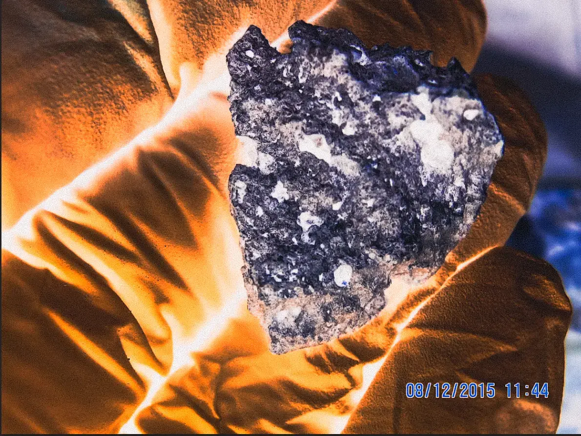
The CWM property contains active and closed hazardous-waste landfills. A radiological survey found three radioactive fragments near the closed SLF-12 landfill. Laboratory testing detected radium-226, thorium-230, and uranium; Niagara County later identified the fragments as radioactive slag.
Former LOOW tractCesium-137 at Modern Disposal
Modern Disposal operates a separate solid-waste landfill on another former-LOOW tract. After an initial cleanup, a federal survey intentionally tested the places most likely to remain contaminated, so its results describe hotspots rather than average conditions across the property. The highest surface-soil sample contained 1,025 picocuries per gram of cesium-137—roughly 1,000 times the highest local background level measured by DOE. After more soil was removed, the highest remaining sample still measured 69 pCi/g: about 65 times local background and more than twice DOE’s later cleanup guideline of 33 pCi/g.
About 1.5 miles west of NFSS, the Lewiston-Porter school campus serves roughly 2,100 students from pre-kindergarten through 12th grade. The campus lies immediately west of the former LOOW boundary. A former 30-inch LOOW outfall line crossed school property. As part of its investigation of the former LOOW property, the Army Corps surveyed the school grounds in 2002. Readings above 8,000 counts per minute required further investigation. One rock behind the elementary school registered 38,222 CPM—nearly five times that trigger.
2008 health investigationChildhood cancer was approximately 80% higher than expected in the Lewiston-Porter School District.Read the findings
A 2008 New York State Department of Health investigation examined cancer incidence in communities surrounding NFSS and the former LOOW property. It found more cases than expected in several categories. Childhood cancer in the Lewiston-Porter School District was about 80 percent higher than expected, a statistically significant excess. The investigation could not identify a cause. It therefore cannot prove that LOOW or CWM caused the excess—but that limitation does not erase the excess the investigation recorded.
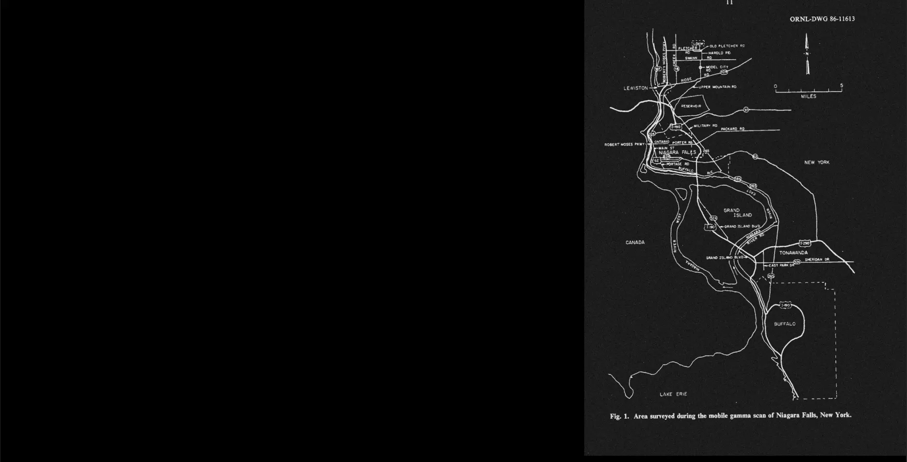
ORNL/TM-10076 · Area surveyed during the mobile gamma scan of Niagara Falls
Chapter IV
The surveys
Following the radioactive trail
What decades of surveys revealed across Niagara
Although the contamination was recorded in federal technical reports, the findings were not shared at the time with the people living or working at the affected properties.
The investigation triggered by the Love Canal environmental disaster revealed only one part of a much larger story. It exposed how radioactive waste had been handled at LOOW and documented that contaminated gravel had already been carried away from the Lake Ontario Storage Area (LOSA) and reused elsewhere. Federal researchers then surveyed the wider Niagara region to locate other areas of elevated radiation. Their reports were often vague about why particular roads and properties were examined, generally describing the search as an investigation of suspected routes used to transport radioactive material from Niagara factories to LOOW. Aircraft and vehicle scans identified radiation anomalies; ground teams then visited and sampled those locations. What emerged was not one clearly defined transport trail, but radioactive material along roads and on the exterior grounds of homes, businesses, former factories, and other properties across the region.
1979–1985
From aerial survey to mobile scan.
The Department of Energy’s regional investigation began by mapping elevated radiation before ground measurements could determine its source. EG&G conducted an exploratory aerial survey in November 1978 and a more sensitive helicopter follow-up in September 1979. Oak Ridge National Laboratory later carried out a vehicle-mounted gamma survey in October 1984, followed by onsite measurements and soil sampling in July 1985.
The investigation began with one federal hypothesis: hotspots along roads and properties might mark material lost from trucks carrying radioactive waste to LOOW. The ground investigation revealed a more complicated pattern. Some locations exceeded federal cleanup guidelines, while most of the remaining anomalies were associated with radioactive industrial slag.
The surveys therefore did not reveal one trail leading to one disposal site. They revealed overlapping waste histories: possible federal material associated with LOOW and radioactive residues produced by Niagara industries, some of which had been reused as construction fill.
Once industrial slag emerged as a source of contamination, the search could no longer be confined to suspected routes leading to LOOW. Later radiological surveys examined former factory properties and redevelopment sites, especially within Niagara Falls’s two principal industrial districts: the Buffalo Avenue corridor along the river and the Highland Avenue corridor beside residential neighborhoods.
1979 aerial radiological survey commissioned by the U.S. Department of Energy
The aerial surveys mapped radiation above the surrounding background across broad areas. Because airborne readings averaged radiation over several acres, they could not identify the precise source or property responsible. Ground measurements were required.
1984–1985 Oak Ridge vehicle and ground radiological surveys for the U.S. Department of Energy
A vehicle survey identified 100 gamma anomalies for follow-up. In 1985, ORNL measured and sampled exterior locations—not the interiors of homes or businesses. Thirty-eight anomalies exceeded FUSRAP guidelines; the remaining 62 were associated with radioactive industrial slag beneath asphalt driveways and parking lots.
One of the properties identified by the federal surveys was 789 Upper Mountain Road in Lewiston. Oak Ridge National Laboratory’s 1986 report recorded gamma radiation at the property approximately five times higher than local background and attributed it to slag containing elevated levels of thorium. But once Oak Ridge had the results, the people living or working at the homes, businesses, and other properties documented by the survey were not informed. The Palmeri family purchased the house in 2011 without knowing that federal researchers had recorded radioactive contamination there decades earlier.
After Tracey Palmeri’s cancer diagnosis, the Palmeris hired an environmental consultant, who measured gamma radiation as high as 30 times background in the crawl space beneath their home. They shared the findings with state health officials, who alerted the EPA. In 2020, the agency determined that gamma radiation, radon gas, and radioactive dust from contaminated soil presented an unacceptable risk. The Palmeris were relocated in September 2021 while the EPA began excavating beneath the house and across the surrounding property. During the excavation, workers found radioactive sand, slag, ash, refractory brick, and eight metal product-testing plates bearing the names Titanium Alloys Manufacturing and TAMCO—evidence connecting the waste to a company then owned by NL Industries.
Over three years, the EPA removed approximately 4,800 tons of radioactive waste from the Palmeri property and an adjacent lot in a cleanup costing more than $7 million. The EPA completed the cleanup in 2023.
Tracey Palmeri died from breast cancer in April 2022 at the age of 44. Her husband later filed a wrongful-death lawsuit alleging that exposure to the radioactive waste caused her illness. The excavation established the presence of radioactive industrial waste and produced evidence of its likely source; it did not establish whether the exposure caused her cancer.
Many of the survey’s other anomalies involved a different material: phosphate slag generated by Niagara Falls’s elemental-phosphorus industry. The operation began under Oldbury Electrochemical, was later acquired by Hooker Chemical, and ultimately became part of Occidental Chemical. A 1978 Occidental letter acknowledged that slag from the company’s phosphorus operations had been sold to local construction contractors, transported to a landfill, or left near its former facilities. ORNL later identified phosphate slag beneath asphalt driveways and parking lots at dozens of surveyed locations, although it did not establish the producer of the material at every property.
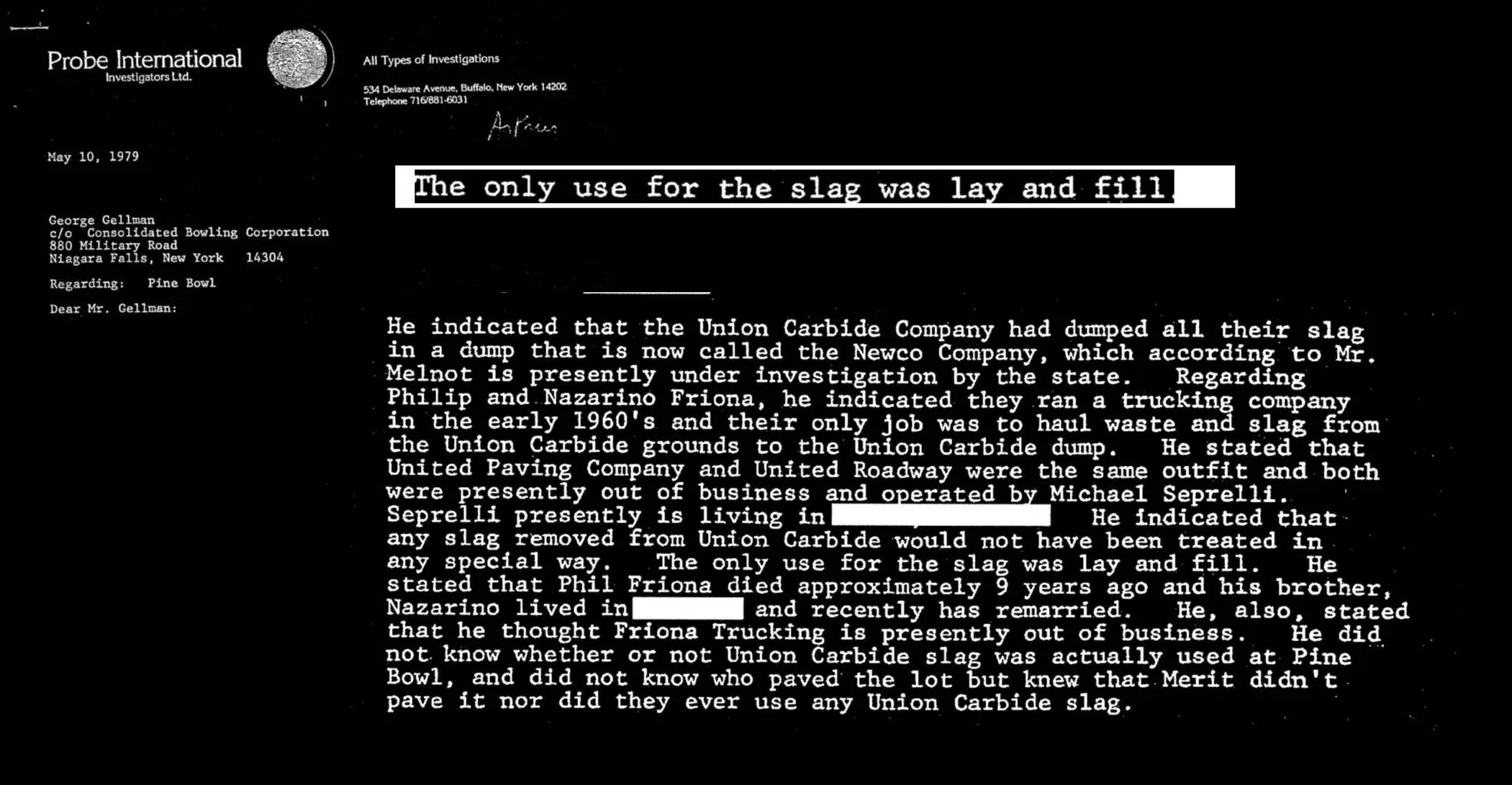
In 2017, Investigative Post journalist Dan Telvock made public two private-investigator reports prepared in 1979 for the owner of the Pine Bowl parking lot. The investigator was trying to identify the source of the slag beneath the property, pursuing several possibilities—including Union Carbide, Pittsburgh Metallurgical/Airco Alloys, Oldbury, and Buffalo Slag—but incomplete records prevented him from conclusively tracing the material.
His interviews nevertheless revealed how widely industrial slag had circulated through Niagara Falls. People familiar with Union Carbide’s disposal practices described Friona Trucking hauling waste and slag from the company’s Niagara Falls property to its dump, then known as Newco and now incorporated into the CECOS hazardous-waste facility. They said untreated slag was also sold or given away as inexpensive fill. One contractor estimated that Union Carbide slag had been used beneath “half the parking lots in the Falls.” Angelo Marchetti identified King’s Plaza on Military Road and John’s Flaming Hearth as examples. These were accounts given to the investigator, not the findings of a systematic survey, but they described a commercial distribution network extending well beyond the company’s property.
Telvock had begun investigating Niagara’s radioactive hotspots in 2016. Rather than conduct a new survey, he returned to Oak Ridge National Laboratory’s 1985 record of 100 radiological anomalies and traced what happened to those locations. He compared the survey with later cleanup records and found a crucial divide: federal cleanup focused on properties connected to Manhattan Project waste, while many locations attributed to industrial slag remained outside the program.
One of those locations was 789 Upper Mountain Road, where Oak Ridge researchers had measured elevated radiation in a driveway decades earlier. The property was never included in federal cleanup. The same was true for dozens of other addresses recorded in the 1985 survey. Although the government had documented the radiation, many people living or working at those locations were never notified that their properties appeared in a federal radiological investigation.
The 1979 reports did not prove that Union Carbide slag had been used at Pine Bowl. What they exposed was a poorly documented trade in industrial slag moving through factories, haulers, company dumps, commercial suppliers, and construction sites—a distribution history far broader than federal cleanup boundaries could explain.
The project began with a warning, grew into a four-year ongoing investigation, and expanded through photography, fieldwork, maps, technical files, worker records, and thousands of archival pages.
How the project began · 2023
A personal story opened a larger investigation.
In 2023, my close friend Alex O’Malley told me that she had grown up in Niagara Falls, where her family had lived for four generations. She also shared that she and two of her siblings had the same thyroid condition, which they had been told was not hereditary. That pattern immediately raised an environmental question for me. When I asked Alex about the place itself, she answered:
“It’s polluted—very polluted.”
Alex O’Malley · fourth-generation Niagara Falls resident
The warning prompted me to write my own 25-page report, Cancer Town: Unveiling Niagara Falls’ Radioactive Secret. Through that first report, I began teaching myself about Niagara’s industrial history, its role in the Manhattan Project, and the radioactive waste those industries left behind.
I first photographed Niagara Falls from October 4 through October 7, 2023. I documented the tourist landscape, former factory districts, Love Canal, LOOW, and residents living beside places where federal surveys had measured elevated radiation. But the landscape could not answer the questions my photographs raised: What had been produced at each factory? Where had the waste gone? Which properties had been surveyed? Had the people living or working there ever been told?
My investigation widened as I followed New York State’s official record of Love Canal—its discovery, investigation, emergency response, and cleanup. From there, I found the 1985 federal radiological survey and began examining brownfield redevelopment across Niagara, where historical research and radiological surveys repeatedly appeared alongside plans for reuse. Read together, these records did not describe isolated events. They revealed a long, interconnected history of industrial contamination, radioactive waste, redevelopment, and communities left to live with what remained.
The research expanded through records that had never been read together.
I continued the investigation through Department of Energy and Army Corps records, NIOSH dose-reconstruction files, state and federal cleanup documents, environmental easements, Sanborn maps, property records, historical directories, archival films, court arguments, newspapers, public meetings, academic research, and interviews.
Factories appeared under different owners and names. Industrial properties were divided, sold, and redeveloped. I found that one location could reappear across decades in a production record, a worker-exposure file, a radiological survey, a brownfield investigation, and a cleanup document—without any agency ever assembling those fragments into one history.
Worker records
NIOSH files
Dose-reconstruction reports preserved facility-level histories of radioactive processes, materials, and exposure beyond the factories emphasized in the 1981 report.
Fire-insurance maps, parcel records, and historical directories helped locate former plants, track changing names, and connect factory grounds to the properties that replaced them.
The official record never became a complete public accounting. The project’s Archive of Evidence brings scattered source files into one searchable collection. The Interactive Map connects them to factories, disposal areas, roads, waterways, homes, schools, and public spaces.
It does not assign every radioactive finding to one source. It shows why no single survey, agency, cleanup program, or industrial history can explain the whole landscape.
How the record expanded
More factories entered the record.
The 1981 report The Federal Connection established a federal network linking Linde, Electromet, Hooker, and LOOW, but it was never a complete inventory of Niagara facilities that handled radioactive material.
Reading that report alongside worker-exposure files, historical maps, property records, and radiological surveys brought additional factories, former industrial sites, and redevelopment properties into the same record.
For over eight decades, the government’s silence and the lack of a comprehensive plan to address radioactive contamination have proven deadly to the Falls.
A patchwork, not a plan
No one program is responsible for the whole geography.
Los Alamos became the public symbol of the Manhattan Project, but the bomb was the product of a dispersed national system of laboratories, refineries, metal plants, storage depots, transport routes, and disposal grounds. Niagara was one of its densest industrial landscapes.
The fifteen Niagara Frontier sites mapped by this project are not all FUSRAP properties. Some fall under FUSRAP, some under Superfund or the Formerly Used Defense Sites program, some under New York State cleanup and brownfield programs, and others sit outside any single comprehensive federal investigation.
The brownfield fallacy
Remediated does not mean erased.
Superfund is a federal cleanup and enforcement program. A brownfield is a property whose contamination complicates reuse or redevelopment. In New York, private owners and developers can enter the state Brownfield Cleanup Program, complete a DEC-approved remedy, and receive a Certificate of Completion. That certificate can unlock refundable tax credits for site preparation, groundwater cleanup, and redevelopment costs—including buildings and other qualifying property. The size of the credit depends on the cleanup level, intended use, location, and project type.
Brownfield remediation is often risk-based. The cleanup is designed around the property’s intended future use, and it may leave contaminated soil or fill in place beneath clean soil, asphalt, concrete, or another protective barrier. Environmental easements, site-management plans, and restrictions on excavation or groundwater use may then be required to prevent exposure.
The cleanup standard follows the property’s intended use. A site remediated only for commercial use may qualify for tax credits and be approved for shops, offices, a mall, or a hotel while still failing to meet the cleanup standard required for housing. If the use changes—or if construction disturbs the protective cap—additional investigation or cleanup may be required.
2023–present
The new surveys return to the region.
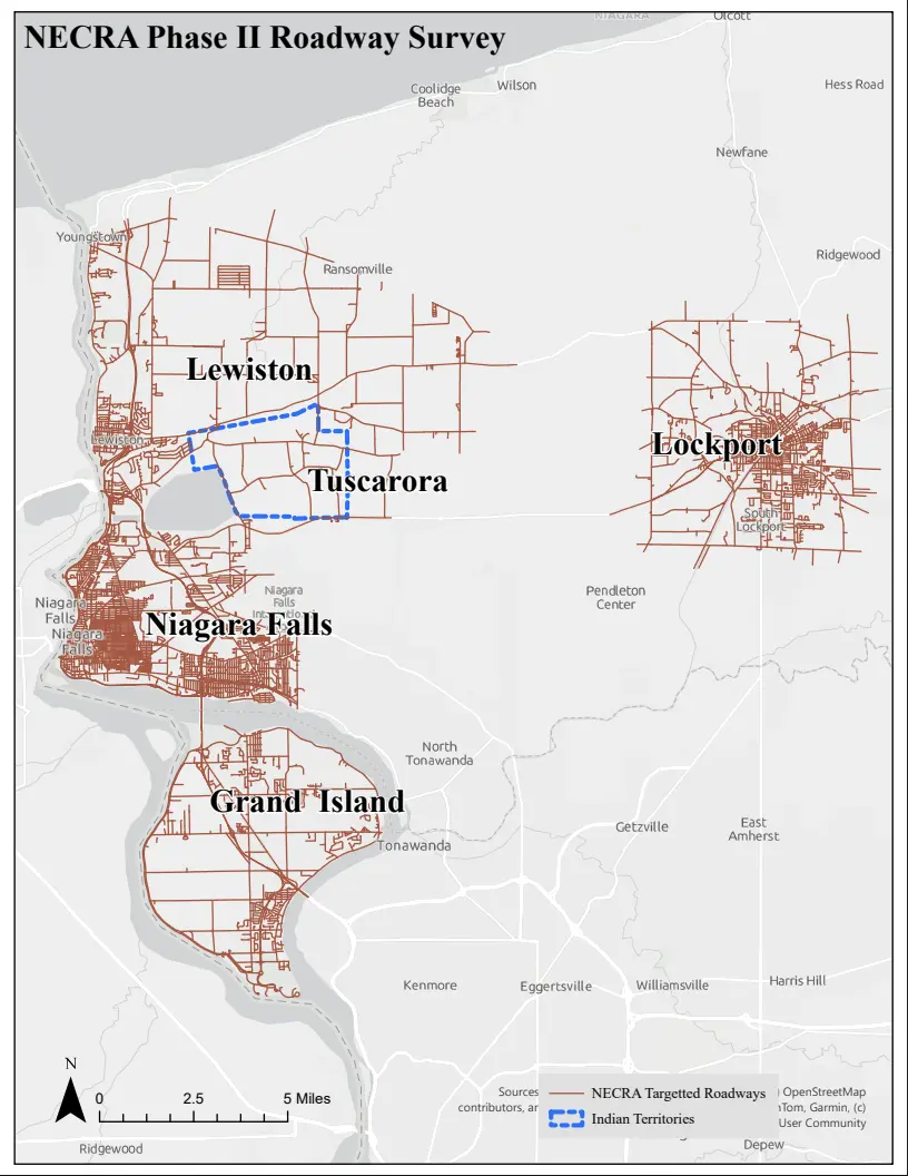
The limitations of the earlier surveys became visible as new hotspots appeared during roadwork, repairs, and construction. DEC and EPA began a new regional radiological assessment in 2023, then moved from aircraft scanning to road-level measurements and property follow-up.
In Niagara Falls, no site developed or redeveloped after the 1940s should be presumed free of radioactive fill without testing. The same applies to roads, driveways, and sidewalks.
The animation below shows one gap in that system: excavated slag or fill may be carried directly from one property to another without ever passing through a landfill radiation detector.
“Cancer incidence generally remains higher in this region than in the state and nationwide.”
Roswell Park Comprehensive Cancer Center · WNY Cancer Snapshot · 2022
The burden extends beyond cancer.
Cancer incidence in Western New York generally remains above state and national rates. In 2019, Roswell Park reported that Niagara County ranked sixth among New York’s 62 counties for cancer incidence and that its cancer death rate was nearly 36 percent above the state average.
A 2001 peer-reviewed study examined hospital diagnoses among residents living within 15 miles of the Buffalo River, Niagara River, and Eighteen Mile Creek—three contiguous Western New York Areas of Concern. It found significantly elevated thyroid disorders among women older than 25 in every age group and across all three comparison populations.
The researchers also found increased diseases of the female genital tract and significantly elevated endometriosis among women ages 25–44. All of the reported elevations were significant at the 99 percent confidence level.
The study did not establish causation. Its authors cautioned that many factors influence thyroid and genital diseases, while concluding that the findings were consistent with the hypothesis that exposure to environmental contaminants through residence near polluted sites may be a factor.
Most regional health analyses still do not reconstruct exposure to radioactive fill dispersed beneath roads, homes, schools, and public spaces. Together, the studies document a burden without resolving its sources.
Niagara County · 20196th
Cancer-incidence rank among New York’s 62 counties, reported by Roswell Park.
Niagara County · 2019+36%
Approximate cancer death rate above the New York State average, reported by Roswell Park.
Lewiston-Porter · 2008+80%
Approximate excess of childhood cancer recorded in the school district. The investigation could not identify a cause.
Western New York · 20013 of 3
Comparison populations in which thyroid disorders among women older than 25 remained significantly elevated.